Early Yayoi rice paddies in Nara
The site of Karako-Kagi, mentioned above, is located in the central part of the Nara basin (Figure 15.ι). Excavated repeatedly since 1936, it is regarded as a classic example of a Yayoi agricultural settlement, enclosed by ditches, with
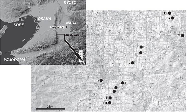
Figure 15.1 The distribution of final Jomon and early Yayoi sites in the southern Nara basin.
1. Shijo-shinano; 2. Jimyoji; 3. Kashiwara; 4. Kawanishi-nenarigaki; 5. Haginomoto;
6. Kannonji-honma; 7. Kamotsuba; 8. Tamade; 9. Saragi; 10. Imade; 11. Akitsu; 12. Nakanishi.
large buildings and bronze-working workshops, with clusters of rectangular burial enclosures (hokei shukobo gun) in the vicinity. No paddy fields, however, have been found associated with Karako-Kagi.
A number of large-scale excavations were recently undertaken in the southwestern Nara basin in advance of the Keinawa expressway linking Kyoto, Nara, and Wakayama, which crosses the basin from north to south. The area affected by the construction of the new road had been paddy since at least medieval times and, unlike many of the more urbanized parts of the region, had not been developed for industrial or commercial purposes. For this reason, very few large archaeological sites have been discovered to date. Evaluation surveys undertaken along the proposed route of the new road, however, demonstrated the presence of a series of major sites.
The first discovery of paddy remains in the Nara basin, at Haginomoto in Kashihara, was made in conjunction with the construction of this new road.[808] An area of rice paddy, some 1,800 m2 in extent, was discovered sealed by layers of fine sands. This area was divided by 5 cm high ridges into small rectangular paddies, each about 2.5 ? 4 m in area, what we would now identify as ‘small-section paddies' (shokukaku suiden) (Figure 15.2).
This type of paddy was also found at the Tamade site in Gose city, about 2.4 km southwest of Haginomoto.[809]Here, middle and late Yayoi paddies formed an upper layer, beneath which were sealed early Yayoi paddies. Beneath this were discovered remains from the late final Jomon, including traces of buildings, burial pits, and pottery dumps (Figure 15.3). The early Yayoi paddies extended over 4,800 m2 and formed two layers, separated by a layer of sand. As at Haginomoto, both layers at Tamade comprised small-section paddies. The long ridges were aligned parallel to the natural contours at 1.5 m intervals, with short ridges at right angles to the long ones every 3.5-5.5 m creating a series of small
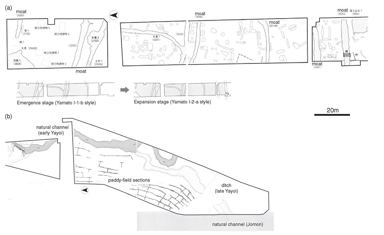
Figure 15.2 Early Yayoi paddy fields and settlement at (a) Kawanishi-Negarigaki, a moated circular settlement of the Early Yayoi period; and (b) Haginomoto, the first paddy fields of the Early Yayoi period found in the Ner basin.
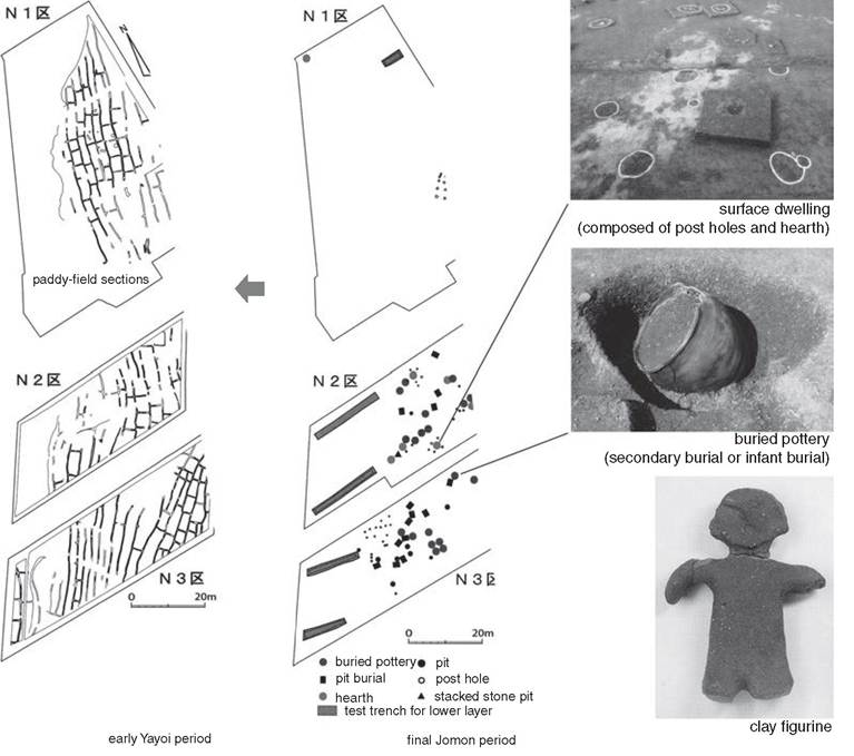
Figure 15.3 The transition from the final Jomon settlement to early Yayoi paddy fields at Tamade.
rectangular units. At Tamade the ridges of the later phase were reoriented by 90 degrees from the earlier phase.
This technique of constructing small-section paddies appears to have been designed to create as much flat area as possible in sloping and hilly terrain with the least effort. The ridges were carefully planned to ensure that the water irrigated all the paddies. It is significant that these ridges were realigned in the later phase. It is also thought that, following the abandonment of the late final Jomon settlement, the area was left for a while, and reclaimed for paddy for rice cultivation during the early Yayoi. Although we do not know how long the paddy was in operation during the Yayoi, the sand layer indicates that it was flooded at least once. The people working the paddies did not completely give up, however, and reconstructed their paddies, adjusting them to the changes in local topography wrought by the inundation. The discovery of these early Yayoi paddies in the Nara basin was followed by that of much larger-scale paddies and associated facilities which extended over an area of more than 25,000 m2 at the Nakanishi- Akitsu site complex.