Landscape
The three localities of Xinglonggou are all on the left bank of the Mangniu River to the north of the Qilaotu mountains. The early Neolithic settlement, Xinglonggou ι, is situated on a sloped loess accumulation on the second terrace of the river (Figure 13.2).
The advantage of such a location to early farmers was its spatially constricted but highly productive soils that accumulate in the catchments of springs and seasonal streams. At those locations, until very recently, a small-scale horticultural version of what is generally known as ‘catchment farming' has largely been practised. As the East Asian monsoon reached its Holocene maximum, the flow of water wasXinglonggou, China
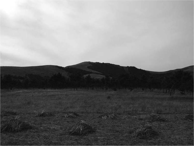
Figure 13.2 Xinglonggou I, looking northwest.
more substantial than today. Vegetation growth was constrained by the seasonality of water flow from springs and streams, favouring annual grasses. The composition of the resulting grassy stands could be modified by selective clearance. This would in particular be true on northern slopes, because on the southern foothills the fluvial dynamic would be higher, favouring deep-rooted perennials. Such a dynamic is still visible today: Figure 13.3 illustrates a northern foothill in Chifeng where two weedy forms of millet, Setaria viridis and Panicum miliaceum var. ruderale, are flourishing in the uncultivated area alongside the cultivated fields of broomcorn millet and maize.
Xinglonggou I is one of a number of early Neolithic sites in this region situated in such a location: Xinglongwa, Baiyinchanghan, Chahai, and Nantaizi, for example, are all located on the slope of north-facing foothills. This is in contrast to sites of the late Neolithic Hongshan period and the Bronze Age lower Xiajiadian period, which are typically situated closer to the courses of rivers.
No early Neolithic sites are found on a flat valley floor, and few are found on the higher mountains far from major rivers. Twelve of the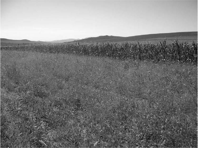
Figure 13.3 Cultivated fields of maize and weedy millet near Xinglonggou.
sites from the Xinglongwa period are located on upland slopes, typically more than 40-50 m above river channels.[704] [705]
It appears that the dynamic between the Holocene hydrological system in Chifeng and the Quaternary loess accumulation is the key to understanding the human occupation systems of different episodes in prehistory. A geoarch- aeological study has hypothesized three stages of the development of the Chifeng riverine system in relation to locations of Neolithic and Bronze Age sites.16 The initial development of the fluvial system in southern Chifeng dates to between 6000 and 4500 bce. During this period, the landscape was dominated by loess slopes and loess plains between hills and young rivers. Early Neolithic anthropogenic deposits of the Xinglongwa culture are often situated on top of the Quaternary loess accumulation. As the fluvial system developed, a significant downcutting happened between 4500 and 2000 bce,
Xinglonggou, China
forming the second terrace of the rivers. Many late Neolithic anthropogenic activities of the Hongshan period are found on the alluvial sediments of this terrace, indicating that they are younger than the formation of the terrace. A subsequent downcutting after 2000 bce formed the first terrace of the rivers. The Bronze Age cultural layers of the lower Xiajiadian period are often found either on the first terrace or on top of the Holocene loess deposits of the second terrace. Although the model is based on the integration of wider geographic surveys, the topographical relations of Xinglonggou ι, ii, and ιιι are broadly in accord with it. The same topographical preference is observed at a number of other early Neolithic sites across northern China and further resonates with the geographic settings of early agricultural sites in Southwest Asia:[706] in the Jordan valley, for example, Claudio Vita-Finzi observed a similar three-stage development of site locations and noted the ‘geographic opportunism' of the first farmers there.1[707]